Moths
The species account pages give detailed information about each moth. Species accounts are displayed in order of the ABH number, which describes the currently understood taxonomy of the UK species. Users can follow the previous and next links above the header to navigate to closely related species, or click the name of the taxonomic family to view thumbnails of all members of that family recorded in D&G. The Bradley & Fletcher number for each species is also given, along with any alternative common names used previously.
The header includes a grading for how difficult the species is to identify and the requirements for acceptance of records. Many species are easily identifiable in the field or from a photograph, but identification to species level for some is more challenging. More information is provided in the ‘Species identification grading and difficult to ID species’ page.
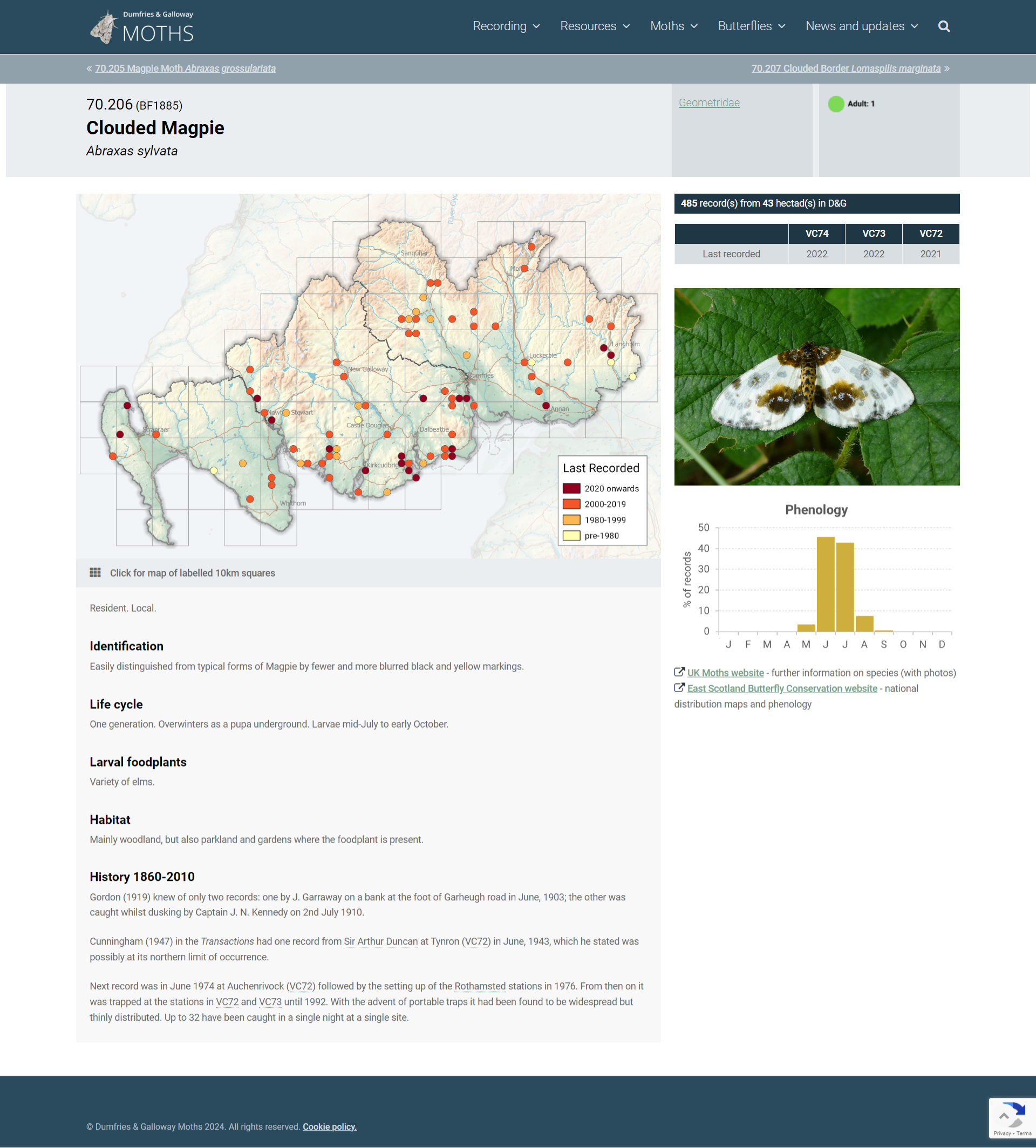
The distribution map shows records for all years up to and including 2022 at tetrad scale (2×2 km squares) for the whole of D&G. Any records that were of lower precision, such as those where occurrence is only recorded at Vice County or hectad (10 km sq) level, are not displayed. These are relatively few in number, and are typically historical records.
Summary information on the number of records for each species is tabulated at the top of the right-hand column.
A gallery of images is provided. Wherever possible the images show specimens found in Dumfries and Galloway. Where no local photograph exists, these have been supplemented by images from outwith the region.
Phenology charts derived from local data are included for most macro moth species. These charts show records of all life cycle stages, not just adults. No phenology charts are included for micros since the recording effort for most species is insufficient to provide meaningful information.
Additional links are provided to external sites for the species. The UK moths website includes photos and links to countrywide distribution maps generated from information stored on the NBN Atlas. The East Scotland Butterfly Conservation website shows distribution maps and phenology charts for the whole of Scotland, which provides a useful national context for D&G records.
Butterflies
The butterfly pages on this website are currently in development. The distribution maps are created by Butterfly Conservation and show records up to and including 2020 (to be confirmed). More information will be added in due course.